Case Study:
Enhancing rural road safety in Georgia
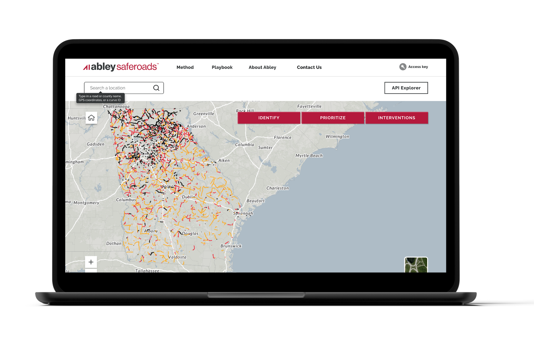
SafeRoads is an innovative road safety analysis platform that transforms complex data into actionable intelligence. This collaboration with the Georgia Department of Transportation (GDOT), Esri, The Ray, and Abley demonstrates a best practice, Safe System Approach to road safety. By using SafeRoads, the team was able to identify high-risk segments and quantify potential safety improvements, enabling evidence-based decisions that will maximize road safety outcomes.
The Challenge
Rural roads in Georgia contribute disproportionately to road trauma despite representing a small percentage of the overall road network. Our SafeRoads assessment revealed:
-
31,400 people were killed or seriously injured on rural roads in Georgia between 2013-2022
-
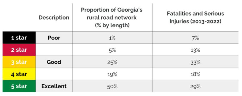
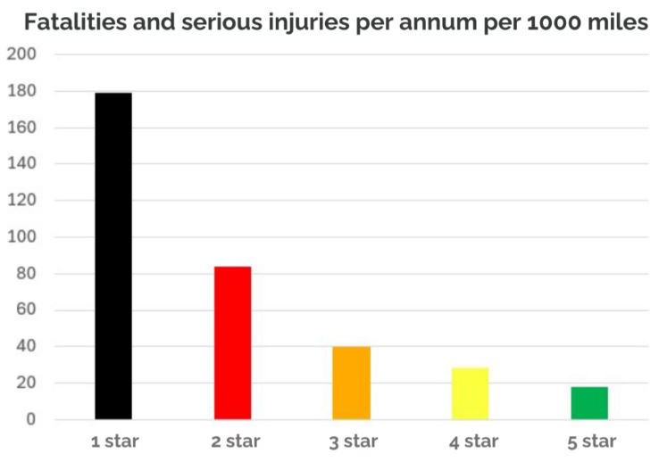
Only 6% of Georgia's rural roads (by length) are rated as 1 star or 2 star
-
These high risk roads accounted for 20% of all fatalities and serious injuries (over 6,000 people)
Impact Analysis: Statewide Results
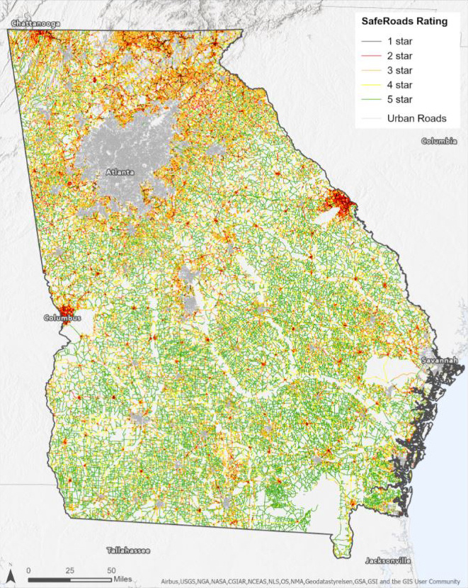
SafeRoads identified approximately 1,800 miles of Georgia's state road network as 1 star and 2 star roads. By upgrading these segments to met the 3 star global safety target, we could save approximately 125 death and serious injuries per annum.
Carroll County Case Study
We selected Carroll County to demonstrate the practical application of SafeRoads at the local level.
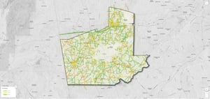
93% of Carroll County's rural roads already meet the 3 star or greater standard
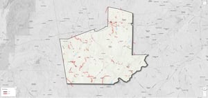
The remaining 7% of roads (rated 1 star or 2 star) disproportionately account for 20% of all deaths and serious injuries. These high risk roads result in approximately 13 people killed or seriously injured annually.*
*2013-2022 crash data
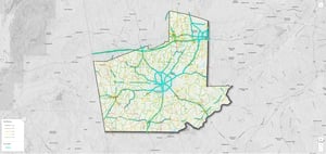
Meeting Global Safety Standards
The WHO/UN Target 4 states that by 2030, more than 75% of travel should occur on roads that meet safety technical standards (3 star or better). In Carroll County, 204 miles of rural roads carry 75% of all travel and of those, 35 miles have a 1 star or 2 star rating. These roads currently do not achieve the global road safety target.
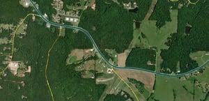
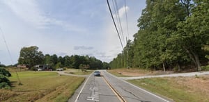
An example of a 1 star road
The following features make this a 1 star road:
- Rural residential
- Undivided
- Very narrow shoulder
- Medium lane width
- Curved alignment
- High/moderate hazards
- 6,000-12,000 vehicles per day
- 55 mph speed limit
- 3-5 intersections per mile
- 5-10 accesses per mile
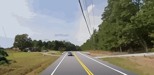
Targeted upgrade solutions
We have identified interventions to upgrade this road to a 3 star to meet the UN/WHO global safety target.
Safety benefits
SafeRoads analysis demonstrates substantial life-saving potential through strategic upgrades:
-
State Roads: Upgrading 1,819 miles to 3-star+ would save approximately 125 deaths and serious injuries annually
-
Carroll County: Upgrading 86 miles to 3-star+ would save approximately 3 deaths and serious injuries annually
-
Statewide Impact: Upgrading 6,230 miles to 3-star+ would save 387 deaths and serious injuries annually
Discover SafeRoads:
Comprehensive rural road risk analysis for every state network with Abley SafeRoads.
Get in touch
Send us an email to learn how SafeRoads can support your organization’s road safety goals.
We are passionate about inspiring positive change.
Abley is a specialist New Zealand owned transport planning, road safety and geospatial technology company. Founded in 2003, we work with organizations in the U.S., Canada, New Zealand, Australia and Indonesia, across central and local governments as well as large organizations.
