.png?width=556&height=152&name=Abley_MasterLogo-Website%20(1).png "logo")


Digital & Spatial Technology
We provide spatial, software, and data solutions delivering successful projects for private companies, utility providers, councils, and national transport agencies in New Zealand, Australia, Asia Pacific, and the USA.


We work with clients to deliver a range of geospatial technologies and GIS tools to analyse and visualise spatial data, uncover spatial relationships, and tackle geographical and location-based challenges.
Our Digital and Spatial team provide integrated services including the optimisation of GIS systems and integrating with internal business systems to provide more value.
We integrate with multiple technology platforms including Esri ArcGIS Enterprise, ArcGIS Online, open source GIS, GeoServer, FME, Geodatabases, AWS, Azure, Windows Server, Linux, ArcGIS Experience Builder, and the ArcGIS Maps SDK for JavaScript.
We work with clients to integrate systems, streamline complex data processes, and extract business intelligence to get the most from their data.
Our qualified data specialists provide reliable on-demand data integrations, delivering solutions and service interfaces that reduce complexity and increase system reliability.
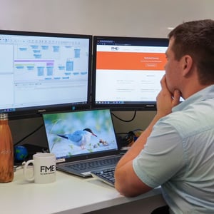
Our key technology is FME, and we provide insights, linking systems and support on-going integration.
We integrate with multiple technology platforms including FME Flow, FME Form, FME Flow Hosted, Geodatabases, SQL, and PostgreSQL.

We work with clients to create applications, integrate, and extend existing systems, or architect scalable cloud-based solutions.
From proof of concept to ongoing development and support, we collaborate with our clients to deliver high value and cost and time-effected outputs, meeting immediate and long-terms needs.
We have key specialist experience in integrating and extending spatial solutions (Esri and open source) with core business systems (i.e., SAP), to enable clients to get the most from their digital investment.
We integrate with multiple technology platforms including: JavaScript, TypeScript, .NET, Python, HTML, CSS, CI/CD, Automated Test Integrations, JEST, pytest, MSTest, Esri and open source GIS, SQL, PostgreSQL , ArcGIS Experience Builder, ArcGIS Maps SDK for JavaScript , Azure, AWS, Windows Server, and Linux.

We are certified experts in FME and work with clients to unlock valuable insights.
FME connects data, applications, and decision-making processes to unlock business potential.
We provide solutions in extracting data from business systems, streamlining complex spatial processes, working with a range of internal and external APIs, and managing the installation of FME.
Unlock FME servers and desktop implementation by booking an FME boost with our professionals.
We are an Esri Bronze Business Partner providing GIS software solutions.
Esri is the world’s leading mapping and analytics software that provides platforms and tools that are the foundation for location-enabled websites, applications, and analysis that involve complex data input, output, and visualisation.
Our experts are approved to use Esri products to provide solutions to problems involved in data and processes. We work with clients to analyse data, enhance existing GIS systems, implement systems, and guide them through their location intelligence strategy.
.jpg?width=300&name=shutterstock_2138033449%20(1).jpg)
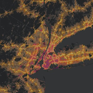
We work with clients to build and maintain data-rich, spatially enhanced, 3D scenes of transport and related infrastructure. We use platforms to share information and support better decision making, improving project efficiency to unlock new business possibilities.
Our Digital Engineering team deliver on complex projects including the concepting of geographical areas making it easier for our clients to imagine how developments will look in real life. We migrate models into design engineering suites to deliver value in the detail design stage of the project.
We integrate with multiple technology platforms including Infraworks, 3D GISef, Cesium, Unreal Engine, Unity, VGIS, FME, and FMEAR.
Features and benefits:
-
Simulations, Augmented Reality, Virtual Reality
-
3D Webmaps, Digital Twins, 3D Modelling
-
Information Management