Case Study:
Enhancing rural road safety in Georgia

 account for 20% of all fatalities and serious injuries, causing over 6,000 casualties from 2013-2022")


Carroll County Case Study
We selected Carroll County to demonstrate the practical application of SafeRoads at the local level.
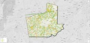
93% of Carroll County's rural roads already meet the 3 star or greater standard
The remaining 7% of roads (rated 1 star or 2 star) disproportionately account for 20% of all deaths and serious injuries. These high risk roads result in approximately 13 people killed or seriously injured annually.*
*2013-2022 crash data
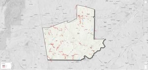
Meeting Global Safety Standards
The WHO/UN Target 4 states that by 2030, more than 75% of travel should occur on roads that meet safety technical standards (3 star or better). In Carroll County, 204 miles of rural roads carry 75% of all travel and of those, 35 miles have a 1 star or 2 star rating. These roads currently do not achieve the global road safety target.
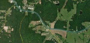
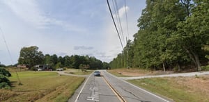
An example of a 1 star road
The following features make this a 1 star road:
- Rural residential
- Undivided
- Very narrow shoulder
- Medium lane width
- Curved alignment
- High/moderate hazards
- 6,000-12,000 vehicles per day
- 55 mph speed limit
- 3-5 intersections per mile
- 5-10 accesses per mile
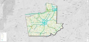
Targeted upgrade solutions
We have identified interventions to upgrade this road to a 3 star to meet the UN/WHO global safety target.