.png?width=556&height=152&name=Abley_MasterLogo-Website%20(1).png "logo")


From 11-15 July 2022, Jeremy Clark from our Location Solutions team attended the Esri International User Conference. Jeremy was there to gain insights into the latest mapping technology, capabilities and upcoming trends for the Esri platform. It was particularly exciting to be able to attend this conference in San Diego, USA face-to-face with other spatial professionals, given all the disruptions we’ve faced due to the pandemic over the past couple of years.
Jeremy summarises his ‘Top 5 Trends and Themes’ from the conference:
The plenary sessions of the 2022 User Conference had a strong climate and sustainability theme. It was a contrasting mix of inspiring, and at the same time concerning, to hear both the efforts undertaken throughout the world to combat climate change, while also hearing examples of the massive challenges we continue to face.
The Special Assistant to the President for Climate Policy, David J. Hayes, provided insights into some of the challenges faced within the United States due to climate change. Similar trends were discussed by Deanne Criswell, the administrator for FEMA who also presented on the spatial challenges resulting from the response and management of ongoing climate change.
It was highlighted that in 2021 alone, 21 major weather events resulted in $145 Billion USD of damage that is directly attributable to climate change, making it not just a financial issue, but an economic one. Similar issues are being encountered in New Zealand, with both 2020 and 2021 setting records for weather related insurance claims.
On the other hand, it was highlighted that there is economic opportunity within addressing the challenges of climate change, with $4.37 Billion USD recently being spent on leases for offshore wind projects throughout the US, and Billions of dollars in funding available for climate focused solutions such as implementing a nationwide charging network.
The presenters reinforced that mapping, as a method of enabling collaboration across the whole of government and the private sector, was a critical tool to tackling the both the existing impacts of climate change and to enable actions that will positively contribute to reducing human impact on the environment. This approach aligned closely with the theme of the conference, “Mapping Common Ground”.
The conference showcased a wide variety of mapping technology, but at the forefront was a significant amount of what we would consider is ‘non-traditional’ mapping, such as Dashboards, StoryMaps and new products such as ArcGIS Knowledge.
These less traditional mapping tools play a huge part of the Esri platform, and it was noted that these applications are some of the most popular, with Dashboards being the second highest usage application in ArcGIS Online.
These non-traditional tools are a huge part of Esri’s mission to democratise GIS throughout the organisation and lower the barrier for entry to create valuable products.
This was particularly evident in a demonstration of the new “ArcGIS for Microsoft 365” (not to be confused with ArcGIS for Office!). This application suite delivered the ability for non-GIS users to geo-enable their data and apps across the Microsoft suite, without having to open an Esri application and understand the in’s and out’s of complex tools such as ArcGIS Pro.
Enabling basic geospatial toolsets throughout the organisation ensures that your internal GIS team can focus on higher value projects, delivering strategic benefits. It was exciting to see the bricks continue to fall in to place to enable this transition.
3. Esri is putting significant effort into supporting data
It was announced at the User Conference that Esri is putting significant effort and funds into improving the data that underlies the ArcGIS ecosystem.
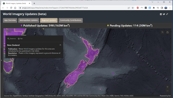
It was highlighted that a significant quantity of new data is on its way, with higher quality POI data coming for the world geocoding service, along with higher resolution Maxar Satellite data being made available for areas of the world including New Zealand.
Alongside new data sources, improvements to the Living Atlas were also highlighted. As new datasets continue to be added to the online library, it was noted that you will soon be able to update the references held within your local ArcGIS Enterprise version to add these new layers as well using an update package.
4. The Esri Enterprise is becoming more dynamic
With ArcGIS Enterprise 11.0 being released in late July, it brings with it significant improvements to the system when handling features and tools that change regularly.
ArcGIS Enterprise 11.0 comes with a Beta version of Service Webhooks, allowing a trigger-like process to occur when features are created/updated, or when a tool completes. This hugely powerful toolset allows users to chain related events off the completion of an activity within their GIS platform, such as triggering an FME workbench to update a related layer when a new point is created in a feature service.
Similarly, the upcoming beta introduction of Custom Data Feeds will also provide the ability to dynamically consume data, without converting it to a traditional Esri format such as points, lines or polygons. This toolset could be hugely powerful for organisations that would like to consume feeds, such as an XML feed of bus locations, and use them live within an Esri app, without having to have a regular ETL process to convert them to spatial features.
These new tools ensure that ArcGIS Enterprise is much more responsive to change and ready to play its part at the core of a dynamic system.
5. The ArcGIS Platform continues to grow, needs to be supported with good advice!
As always, Esri continues to introduce an increasing array of new systems, tools, features, apps and maps to power your geospatial enterprise. This growth increases the breadth of challenge faced when determining and implementing your geospatial strategies, as more tools means more confusion as you try to work out what’s right for you.
A prime example of this challenge is the decision process around what system you should apply for your enterprise GIS.
With the introduction of ArcGIS for Kubernetes, and an increasing focus on ‘Cloud Native’, should that be the toolset for you? Or is Windows on AWS/Azure suitable for you? Should you stay Private Cloud? Or is a hybrid cloud mix of ArcGIS Server and ArcGIS Online the right fit for you?
As Esri’s breadth of tools grows, these questions are going to be faced regularly by our customers, Abley’s team of location technology professionals are well placed to help you determine the tools and applications to support you in your spatial journey.